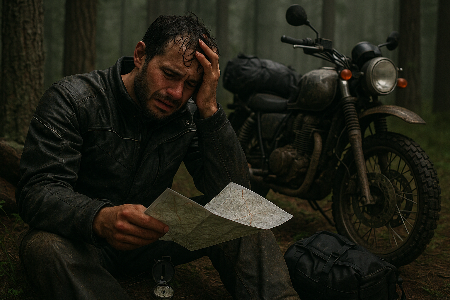
You thought you’d just take the scenic detour. Your GPS showed a thin dirt trail winding through the forest. Seemed faster. Seemed fine.
Now, the sun’s dropping. Trees surround you like a fortress. Your signal’s dead. And your GPS app just glitched into a blank screen.
You’re off-grid.
And without real navigation gear, you’re one dead battery away from becoming a search-and-rescue statistic.
Why Motorcycle Campers Can’t Rely Solely on GPS
While GPS apps are brilliant, motorcycle campers face a unique set of challenges:
- Remote terrain eats signal — canyons, deep woods, deserts.
- Crash damage or water can fry electronics.
- Navigation apps drain batteries fast in cold or remote zones.
- One wrong turn in unfamiliar terrain can spiral into a life-threatening detour.
That’s why off-grid riders don’t just prefer backup navigation — they depend on it.
What you need are tools that don’t rely on signal, updates, satellites, or cell towers.
What you need is a failproof way out.
🚧 The Non-Negotiables: What Real Navigation Gear Must Do
Any off-grid navigation gear for motorcycle camping should check these boxes:
✅ Signal-independent: Works without internet or cellular.
✅ Rugged: Survives drops, dust, rain, and vibration.
✅ Readable in low light or rain.
✅ Battery-efficient or no battery required.
✅ Dual-purpose or lightweight.
✅ Usable in emergency and daily travel.
🧭 Best Off-Grid Navigation Gear for Motorcycle Campers
Let’s break it down into core categories: paper-based tools, digital backup gear, and intuitive natural navigation aids — all rated 4.5+ and available on Amazon.
1. Garmin GPSMAP 67i – Satellite Communicator + Topo Navigation
[Amazon – 4.7 stars]
- Full topo mapping with satellite messaging and SOS functionality.
- Works with no phone and no signal.
- Up to 165 hours battery life.
- Tracks weather, elevation, trails, and your route live.
🧠 Bonus: If you crash and can’t move, its InReach feature lets you send your location via satellite to rescue teams.
2. Silva Ranger 2.0 Compass (Global Needle)
[Amazon – 4.6 stars]
- Military-grade compass with sighting mirror and clinometer.
- Global needle — works anywhere on Earth.
- Glow-in-the-dark markings for night nav.
- Waterproof, shockproof.
🛠 Why It Matters: Even a cheap compass beats a dead GPS. But Silva isn’t cheap — it’s survival-ready and deadly accurate.
3. National Geographic Topographic Map Bundle (Regional Sets)
[Amazon – 4.8 stars]
- Waterproof, tear-resistant, and actually detailed.
- Trailheads, campsites, elevation lines, forest roads.
- Lightweight and folds flat.
🗺️ Pro Tip: Highlight your route before the ride. If GPS dies, this map will show you all bailout points and terrain profiles.
4. Suunto Core Outdoor Watch
[Amazon – 4.5 stars]
- Barometric altimeter, compass, storm alarm.
- Shows elevation gain/loss and direction.
- Sunrise/sunset data for your location.
- Battery lasts over a year — no recharge.
👀 No flashy screens. No reboots. Just raw data from your wrist when you need it most.
5. Garmin Zumo XT2 Motorcycle GPS Navigator
[Amazon – 4.6 stars]
- Purpose-built for off-road motorcycling.
- Works offline. Glove-friendly touch screen.
- Dual-mode topo + street navigation.
- Tracks jump-off points and trail segments.
🏍️ This isn’t your average GPS. It’s designed for the exact moment your main device fails mid-route.
6. Rite in the Rain Tactical Notebook + Grid Sheets
[Amazon – 4.7 stars]
- Waterproof, tearproof, mudproof.
- Use to log routes, trail intersections, fuel stops, elevations.
- Works with any pencil or the brand’s waterproof pen.
✏️ Old school? Maybe. But it works after a crash, a flood, or an EMP.
7. SE Military Lensatic Compass with Pouch
[Amazon – 4.6 stars]
- Budget alternative to Silva but still reliable.
- Glow-in-the-dark bezel.
- Folding sighting lens and sturdy metal housing.
- Accurate enough for dead-reckoning.
🎒 Good to stash as a backup in your panniers or tank bag.
8. Avenza Maps App (Loaded Before You Leave)
[Paired with printed maps]
- Download full topo and park service maps ahead of time.
- Works offline with GPS (not cellular) to show your location.
- Mark waypoints, trails, water sources.
- Add GPX or KML routes before departure.
📲 Pair with your printed maps and compass for a full navigation net.
9. Bushnell BackTrack Mini GPS Tracker
[Amazon – 4.5 stars]
- Tracks your last known location.
- Simple arrow navigation to get back to camp or base.
- Rugged and USB-C rechargeable.
- Pocket-sized and mounts to your bag or belt.
📍 When you just need to find your way back — not map the whole continent.
10. Trail Marking Tape + Glow Reflective Tags
[Amazon – 4.6 stars]
- Flag your entry path into dense woods.
- Reflective tape visible at night with headlamp.
- Tags can mark fuel caches, safe paths, or water sources.
🎯 Primitive, yes. But nothing beats a glowing breadcrumb trail when panic sets in.
🧠 Bonus: Nature Navigation Techniques That Still Work
When everything breaks — no device, no map, no compass — don’t freeze. Fall back on these primal tactics:
🌞 Sun Movement
- In the northern hemisphere, the sun rises in the east, sets in the west.
- Around midday, it’s due south.
- Use your shadow and hand measurements to estimate direction.
🌲 Tree Clues
- Moss may grow on north-facing sides in moist regions — but not always.
- Look for growth patterns: southern-facing slopes are warmer and drier.
- In deserts, plants often lean toward water sources — so does animal traffic.
💧 Water Flow
- Water runs downhill — often toward civilization.
- Follow streams or dry riverbeds cautiously.
- Be alert for changes in terrain slope and erosion patterns.
🌌 Stars
- Polaris (North Star) always points north in the northern hemisphere.
- The Big Dipper’s “pointer stars” can help locate it.
👁️ These clues aren’t 100% accurate but can help orient you if lost.
Packing Strategy: Don’t Overload, Layer Smart
Here’s a battle-tested loadout strategy for motorcycle campers:
| Layer | Navigation Gear | Purpose |
|---|---|---|
| On-body (always accessible) | Suunto Core, Silva Compass, Bushnell BackTrack | Quick-read tools when off-bike |
| Tank Bag / MOLLE pouch | Garmin GPSMAP, Rite in the Rain Notebook, Paper Map | Core navigation brain |
| Saddlebag | Extra printed maps, trail tape, backup compass | Redundancy + field tools |
| App Layer | Avenza, Zumo XT2 | Digital augmentation before signal loss |
Never rely on just one.
Use redundant systems that don’t rely on each other: electronic + paper + sensory.
Real-Life Scenario: When GPS Let Me Down
“I was in Oregon’s Tillamook forest, off Highway 6, following a trail I downloaded days earlier. GPS started lagging, then froze. I kept riding for another hour, thinking I’d reconnect — but never did.
My phone died trying to reroute. I didn’t have cell signal. And I was low on gas.
I used a topo map to backtrack elevation lines, a compass to point south, and followed a stream that eventually hit a logging road. No app could have helped me at that point.”
— Nathan M., Oregon ADV Rider
Don’t Bet Your Life on Bluetooth
Here’s the brutal truth: When the map goes dark, the phone dies, and the towers are gone — most riders freeze.
But freezing kills.
Preparation doesn’t mean carrying 50 gadgets. It means knowing how to use three essential ones:
- A compass
- A map
- A signal-independent GPS or watch
Add one or two digital tools. Layer with natural instinct. You’ll always find a way out.
Final Checklist: Motorcycle Nav Gear That Keeps You Alive
✅ Compass (Silva or SE)
✅ Printed topographic maps
✅ Waterproof notepad
✅ Altimeter watch (Suunto Core)
✅ Off-grid GPS (Garmin GPSMAP / Bushnell / Zumo)
✅ Preloaded map app (Avenza)
✅ Trail tape or glow tags
✅ Star and sun orientation knowledge